 |
| The beach at Grand Lake Saint Marys |
That’s what we called it, just Saint Marys...when we didn’t refer to it simply as “the lake”. That was enough, even though that was really the name of the town, less than half an hour from home, where the lake was, or at least where it began, because it sprawled all the way over and past, to the outer city limits of the next town, Celina, as well. But for us, Saint Marys was the lake, or essentially the town you drove through to get to the lake. Well, unless you happened to be going to an ‘away’ football game, because the Saint Marys Roughriders and the Wapakoneta Redskins were rivals in the high school football league. Bitter rivals, in fact, much more so than with most other teams in the league. By our generation it would have been hard to know why, but some of our grandparents and great-grandparents still knew exactly what that rivalry was all about.

It seems that when Auglaize County was gerrymandered out of parts of the old Allen and Mercer Counties in 1848, a great controversy arose over whether Saint Marys or Wapakoneta should be the county seat. Saint Marys claimed it was the older of the two settlements and felt it should be given the honor for that reason. Indeed, it had been the county seat of Mercer County before the new boundaries made it part of Auglaize and the center of Mercer County’s government was moved to Celina. But the arrival of white settlers in the two towns actually took place within a decade of each other from the 1820s to the 1830s, with Saint Marys being officially founded in 1823 and Wapakoneta in 1833.

 |
Chief Blackhoof (1740-1831)
in a portrait by Charles
Bird King (1785-1862)
|
Wapakoneta argued that it was a more central location for the seat of county government. And besides, if it was a question of seniority, there was the fact that Wapakoneta had been an important settlement for Native American tribes long before the whites ever came to the area. In fact, it had been the council house of the Shawnee nation. The Shawnee had taken over the area from the Ottawa in the late 1700s and in the first decade of the nineteenth century there were hundreds of Shawnee, Mingo and Seneca natives living on the banks of the Auglaize River at Wapakoneta (the place of the white bones in the language of the Shawnee, I’m told), including none other than Blackhoof, chief over all Shawnee in the Ohio Territory. Seen in that way, Wapakoneta was a very big deal among the area’s natives, and thus too in relations between the whites and the Indians. Within three decades, however, white settlers would be building their town at the sight of this prominent Shawnee village, after the US government breached its treaties with the Indians and drove them west of the Mississippi—but not before the death of Blackhoof at what would later be the village of St. Johns, a few miles away. It was Blackhoof who, after fiercely resisting white expansion prior to the War of 1812, would come to the conclusion that the Shawnee should adapt to European ways in order to avoid being wiped out, because, like it or not, the whites were here to stay. It was probably only his newfound allegiance to the white man that kept his people from being robbed of their legacy on the Auglaize sooner rather than later.
 |
| Auglaize County Couthouse as it appears today, without "the Copper Lady" on top. |
So for a long time, Saint Marys couldn’t get over having had the county seat “stolen from it” and Wapakoneta couldn’t get over “being dubbed a cheat”, and that’s how a kind of muted enmity remained between the two towns for years to come (and seeped through history onto the football field long after anybody could recall what the original fight had been about). That was neither here nor there, however, when it came to the lake, which, at least in our family, we sort of considered “our lake”.
 |
| A sprawling 13,500-acre lake, hand-dug by 1700 immigrants. |
Officially named Grand Lake in the US Geographical Survey, it is known locally as Grand Lake Saint Marys—a moniker that has stirred no little jealously and debate between the lake-front cities of Saint Marys and Celina—and that’s even the name posted on Ohio road signs, including those on Interstate 75 and US 33, despite the Federal government’s refusal to add the Saint Marys suffix to official maps. At one time, it was the largest man-made lake in the United States—or as some West-Central Ohioans will boast, “in the world.” And it remains, even today, the largest inland lake in Ohio...if also one of the shallowest with an average depth of six or seven feet. It was hand-excavated over a period of eight years in the 1830s and ‘40s by some seventeen hundred German and Irish immigrants who were paid ‘handsomely’ for their trouble: thirty cents a day plus a jigger of whisky to ward off malaria.
Saint Marys wasn’t always a merely recreational lake, however. It began with a practical purpose: to be a so-called “feeder lake” for the Miami and Erie Canal. Now, in Ohio, when we talk about “Miami”, it’s not America’s most tropical and most Latino city, located a stone's throw from Cuba, that we mean, but rather, the Miami Valley of the Ohio Territory and the river that made it. And it is that Miami that the name of the canal refers to.
Ohio was a wild and remote territory in the early 1800s when it first achieved statehood. Despite having become part of the fledgling United States, which enjoyed certain sophistication in the long-standing former eastern colonies, there were few roads in Ohio and the ones there were turned to quagmires in the rain and snow or were bone-crushing corduroy roads built using some of the thousands of trees felled to clear the sylvan land for farming. Not only luxuries but many of the basics of civilized life were denied to the early settlers of the Ohio interior, cut off as they were by the Appalachian Mountains from the Atlantic ports and by distance and difficult terrain from major freshwater ports on the Ohio River in the south and Great Lake Erie in the north. A solution supported, then, by a number of visionary politicians—including George Washington, prior to his death in 1799—was the construction of a national system of canals.
The first, highly successful one of these was New York’s Erie Canal, which started operating in 1825—and which is still functioning today, if on a much reduced scale from its nineteenth-century days of glory, when it first connected Atlantic Ports to the Great Lakes and handled tens of thousands of shipments a year. Being as we were from a canal county ourselves, if far removed from that great canal system in New York, it was only logical that we should be taught the Erie Canal Song in primary school music classes. And even today, I can’t hear the words “Erie Canal” without that folk tune’s coming to mind:
“I’ve got a mule, her name is Sal,
Fifteen years on the Erie Canal.She’s a good ol’ mule and a good ol’ gal,
Fifteen years on the Erie Canal.
She tows those barges every day,
Filled with corn and coal and hay,
And she knows every inch of the way,
From Albany to Buffalo...”
 |
Horses, like this replica in St. Marys Memorial Park, mules,
or oxen pulled barges like the restored one in this picture,
walking on towpaths beside the canal.
(Photo:Jade Phoenix Pence used under license from Creative Commons -
|
That song aptly describes how the canal barges worked. Without any means of locomotion of their own, they were pulled the entire length of their run by horses, mules, donkeys or oxen, which walked along so-called towpaths that ran exactly parallel to the man-made canal.
The new state of Ohio, then, decided to follow New York’s lead. And that wasn’t the only connection between the two projects, since, once a second stage of Ohio’s own Erie canal system was built in the north, it would literally connect the Ohio River with New York City by linking the two canal systems via Lake Erie, which meant that Ohio would no longer be isolated from the civilized American east.
 |
Excavation for the Miami and Erie Canal in Cincinnati.
|
But the problems that had to be overcome in building Ohio’s Miami and Erie Canal were vastly greater than those of New York’s Erie Canal—which ran roughly parallel to the Hudson River that fed it—and it had to scale much greater heights to those on the other canal’s run. New York’s direct access to Atlantic ports, its much larger population (and thus trade) and the lesser elevations that its canal had to deal with were all factors in its continuing success throughout the 1800s and on into the twentieth century. And these obstacles are clearly what kept Ohio’s Miami and Erie from ever being the great success that New York’s Erie Canal was, and what led to its lingering demise through the latter part of the nineteenth century and to its being abandoned completely in the early part of the twentieth, once the “iron horse” had reached Ohio, swiftly and firmly establishing rail transport as a highly feasible and practical reality in the state.
 |
Lock 13 at Memorial Park in St. Marys, one of over 100
canal locks installed between the Ohio River and Lake Erie
from the 1830s to the 1840s.
(Photo:Jade Phoenix Pence used under license from Creative Commons -
|
Be that as it may, at great expense to the infant state—mostly financed by selling tracts of land on either side of the canal—and with a monumental engineering effort that remains astonishing even today, the Miami and Erie eventually ran more than 300 miles between Cincinnati on the Ohio River and Toledo on Lake Erie. Its operation depended on a sophisticated system of locks to negotiate the almost 400-foot climb above the level of Lake Erie and the more than 500-foot rise above the Ohio River. Its complete construction took two decades (1825 to 1845), at a cost of about 8 million dollars: This too is pretty amazing, since, if economists are to be believed (something I frequently have my doubts about), that amount translates into only about 250 million dollars in current terms for public works that included not only digging the canal and making the towpaths but also constructing over 100 canal locks, a score of aqueducts and a string of feeder canals to get water from reservoirs like Grand Lake Saint Marys (as well as others like Lake Loramie and Indian Lake) into the canal.
 |
Barges could measure 14 feet wide and up to 90 feet long.
|
Quite a lot grander than the sorry ditch that bears testimony to its passing in places where traces of it can still be found—beyond the token runs that have been restored as monuments or for the tourist trade—in its heyday, “Deep Cut”, as the Miami and Erie was sometimes known, was a minimum of four feet deep and 40 feet wide with a ten-foot-wide towpath beside it, and carried barges 14 feet wide and up to 90 feet long in both directions, bearing passengers and every kind of cargo imaginable along its route. Early Ohio industries and businesses grew up along its banks and became the hubs of towns that would flourish from the trade that it afforded them before the days of rail transport.
 |
The east shore of Grand Lake in the 1890s. Note the oil derrick
in the right-hand background.
(Photo from the George Neargarder Collection)
|
While the use of the Miami and Erie Canal waned toward the turn of the century, Grand Lake added another first to its “world’s largest artificial lake” status—one clearly of dubious merit to environmentalists. I know this will sound like an Ohioan’s ridiculous “stretcher”, but I swear it’s true. Grand Lake Saint Marys was the site of the world’s first off-shore oil wells. (I’ll pause for a moment to allow the skeptics among you to get their guffaws and “get-the-hell-outa-heres” under control)... It was during the Ohio oil rush, which sparked the growth of such nearby industrial cities as Lima or Findlay, that, in about 1891, the world’s first offshore drilling rig was set up in the lake, quickly followed by others. The wells were drilled from platforms set on pylons sunk into the lake bed and were developed by local oilmen (Bryson, Riley and Banker’s Oil, among others) who were in fierce competition in the Lima area with John D. Rockefeller’s Standard Oil. The first saltwater offshore drilling wouldn’t follow until half a decade later, in California. The derricks and platforms were, of course, long gone from Grand Lake by the time I first saw it, after it was declared an Ohio State Park in the year of my birth.
For us, however, all of this rich history was only connected to the obscure memory of some fleeting mention our grandparents might have made of Grand Lake’s working past as a key element in operations on the Miami and Erie Canal. To our minds, the sprawling 13,500-acre lake, with its adjacent state park was a glistening gem on the otherwise unbroken surface of the surrounding farmland. It was where family picnics were followed by swimming and horseplay with my cousins in the ever-murky waters, or walks along its grassy, tree-lined shores. It was an exciting place where wealthier families kept their motorboats and canvas awning-topped pontoons moored in the marina during the summer months, and where there were sometimes events in peak season, like speedboat races or fishing competitions.

In the fall months when the leaves were turning and cast their autumnal spell, when Canadian geese gathered and garrisoned briefly to forage and feed before flying south for the winter, it was where, as grown-up teens, we might take our girlfriends to walk hand in hand along the water and steal kisses behind the trees. And in those much colder winters of a less frightening past, the shallow lake froze over and attracted ice fishermen, or pensive adolescents like myself who found the stark black and white landscape of the Ohio snow belt a soothing atmosphere in which to contemplate life and the brilliant, romantic futures we fancied for ourselves.
It was there too that I fell in love. It was in the dead of Ohio winter that Virginia arrived in our town. She was our first Youth For Understanding exchange student. She was from Buenos Aires, Argentina, and she would be staying with us until graduation in the spring. It was my senior year and the first day that I saw her in Spanish class, I was bowled over.
Usually pathologically shy, I put aside my hang-ups when I heard there would be a welcome party for her. She was staying with the family of a girl with whom I had been friends since grade school. I boldly asked Jeannie (my friend) if she would be driving Virginia to the party. When she said she would, I begged her to make up any excuse not to and said I’d volunteer to stand in for her.
The party was being held at the Moulton Gun Club, a stark, white building in the middle of the countryside about halfway between Wapakoneta and Saint Marys, where my grandfather often went to shoot skeet. Late that afternoon, I picked Virginia up at Jeannie’s house in my sleek, waxed and polished, ’61 Dodge Pioneer. I was proud of my car. I had worked since I was twelve and was now eighteen and doing well for myself as a professional musician, musical instrument salesman and private percussion teacher, besides going to high school. This was the second car I had owned in as many years, and a real step up from the rust-laced ’57 Dodge Royal that I had previously purchased for fifty bucks when I was barely sixteen. So I felt flattered when I held open the passenger-side door for her to get in and she said, “What a beautiful car!”
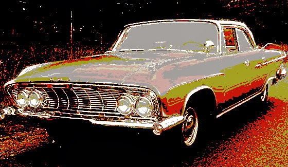 |
| I was proud of my '61 Dodge |
She said, “Would it bother you if I smoked?”
In response, I smiled, reached into the inside pocket of the winter coat I was wearing, and took out my Philip Morris Multi-filters in their classy plastic box, thumbed open the lid one-handed and shook a cigarette part way out, offering it to her. “Here,” I said, “have one of mine.” I handed her my fashionable, grown-up, Ronson gas lighter and watched out of the corner of my eye as she lit up. It seemed to me that I had never seen a more beautiful or sophisticated profile and I knew right then that I was in love. I lit a smoke for myself and pulled open the ashtray on the dash between us.
 |
| Virginia, a few years later at Grand Lake |
For a few seconds we smoked in silence. But then we started to talk and now the words came easier. The first thing she said was that her accent embarrassed her. I said that she hardly had one, that her English was excellent, “kind of British,” and that, anyway, I thought her Spanish accent was charming.
We had started out with plenty of time to get to the gun club. It was winter and the sun was already setting, but, on the spur of the moment, I decided to show my exotic guest some local color. So I drove a few miles out of our way and took her to see Grand Lake Saint Marys. I told her a little of its history, that it was the “world’s largest man-made lake.” She was duly impressed.

It was a stunning winter evening so I parked near the shelter house, and we took a walk along the now frosty shore in the abandoned state park grounds, where picnickers, water skiers, boating enthusiasts, anglers and beach-goers thronged in summer. It was freezing cold and daylight was fading fast, the sun now a creamy ember-orange glint on a snow-clouded horizon beyond the lake. But we strolled there in the dusk for a time and watched the last light of an incredibly beautiful Midwestern winter day reflected on the breeze-ruffled surface of the water that was frozen along the edges. When we got back into the car to go to the gun club for the welcome party, it was as if we already had a tacit understanding between us. We liked each other…a lot.